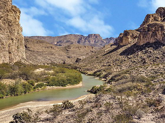
This long, strenuous hike travels through an unforgiving desert landscape set amid the Dead Horse Mountains. Great views of the Sierra Del Carmen and Dead Horse Mountains, an intimate view of the desert and stunning Rio Grande vistas repay hikers for their efforts.
- Distance: 11.0 - 14.0 miles (RT)
- Elevation: 1,870-ft. at Trailhead
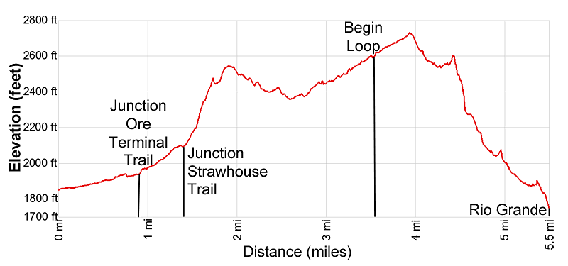
Maximum elevation - 2,730-ft. - Elevation Gain: 860-ft.
- Difficulty: strenuous
- Basecamp: Big Bend
- Region: Texas Parks
Trail Description - Marufo Vega
This trail is only recommended for experienced hikers. It crosses rugged desert terrain where there is little or no shade. The hike is best walked during cooler months and should be avoided when it is hot.
A boot beaten path and cairns will help keep you on track. There is no water along the trail, so take plenty of water. (The park service recommends hikers carry a gallon of water per person.) Talk to a ranger before setting out to obtain the Marufo Vega brochure and to understand current conditions.
Note: There is a lot of elevation gain and loss along the length of the trail. The steepest gain comes on the return leg of the trail. Total elevation gain/loss for the 11.0 mile round-trip hike to the Rio Grande via the North Fork, as described below, is 2,650-ft. The gain/loss on the 14.0 miles loop is over 2,800-ft.
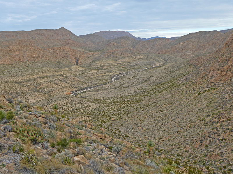
The signed Marufo Vega, Ore Terminal and the Strawhouse trails start on the north side of Boquillas Canyon Road, across from the Marufo Vega Trailhead parking area. (See driving directions below.) The path ascends north on gentle grades through the desert along the west side of the Ernst Valley wash. High cliffs dominate the view to the east. At 0.15 miles the trail drops into and heads north/northwest up the sandy wash.
At 0.6 miles the trail curves to the right and climbs out of the wash, now following a trail ascending gently along the wash’s east bench. Cairns mark the turn and the trail. The path soon passes a collapsed tower of a tramway used to transport ore from a mine in Mexico to a processing facility to the northwest. A rusted iron cable runs northwest from the tower toward the facility.
The trail drops back into the wash at 0.75 miles and reaches a junction at 0.9 miles. Here the Ore Terminal trail continues straight ahead as does the rusted iron cable. We bear right (north) on the Marufo Vega trail that climbs out of the wash and then ascends on easy to moderately-easy grades above the east side of the Ernst Valley, heading toward a hill.
At 1.4 miles the grade steepens as the path climbs up the hill to a pass and a junction at 1.5 miles. The Strawhouse trail continues north up the Ernst Valley. We turn right (east) on the Marufo Vega trail that ascends tight, steeps switchbacks up a rocky ridge. To the north are fine views of the Ernst Valley and the Sierra Del Caballo Muerto (Dead Horse Range). To the south is the Rio Grande.
The grades abates at 1.7 miles as the trail crosses a drainage and then makes a short, steep climb to a pass in the ridge rimming the east side of the Ernst Valley at 1.85 miles. At the pass the path curves to the north/northeast and descends along the west side of a broad valley surrounded by rugged peaks. Ahead Peak 3214 dominates the view. In the distance to the southeast are high cliffs in the Sierra Del Carmen Range in Mexico.
Reach a junction at 2.4 miles. The trail branching left (northwest) connects with the Strawhouse Trail. We continue straight ahead on the Marufo Vega Trail. The path soon crosses a low ridge and a gully before turning north into a wash. Initially the trail ascends on easy grades up the bench along the west side of the wash. At 2.7 miles the path crosses the streambed to the east bench where it resumes its ascent up the wash. The wash soon constricts, forcing the trail into the streambed.
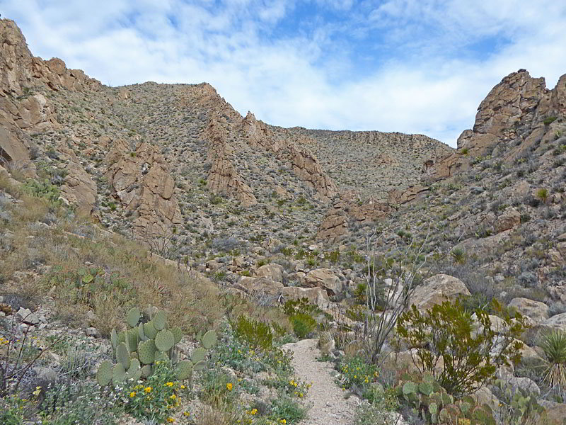
Beyond this point the wash becomes sinuous. To short-cut meanders and avoid obstacles the trail now crosses back and forth between the east and west benches with short stints in the streambed. As you head upstream the slopes lining the wash become more rugged while the floor of the wash gets progressively rockier. At 3.3 miles the wash widens and the walking becomes easier.
The trail reaches a junction with the Marufo Vega Loop at 3.5 miles. Here the trail spits into a North Fork and a South Fork Trail. Both forks lead to the Rio Grande. A connecting trail between the two fork travels on bench high above the river. The connecting trail features great views of the Rio Grande but no access to the river.
The length of the Marufo Vega trail if you do the entire loop is 14.0 miles and is best done as a backpack. I recommend day hikers take the North Fork. The distance to the river is shorter and it is not as steep as the South Fork.
To follow the North Fork trail to the river, bear left (north/northeast) at the junction. The path ascends on easy to moderately easy grades up a drainage to a saddle at 3.9 miles with fine views of a high plateau. The path then descends on moderately steep grades accompanied by good views of the peaks rising to the east and a high ridge towering above the trail to the west.
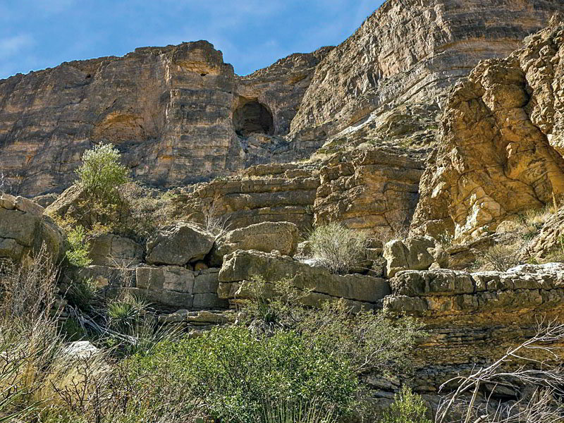
At 4.2 miles the trail reaches the head of a deep canyon where the trail seemingly disappears. Take another look and you will see where the trail drops down into the rugged canyon on very steep grades. After a tenth of a mile the grade eases a bit with the path now descending on steep to moderately-steep grades for 0.5 miles. Colorful canyon walls soar overhead. Be sure to turn around for nice views up the canyon.
At 4.9 miles the grade briefly abates as the path curves to the east, echoing the canyon’s contours, and then turns back to the left (northeast), resuming the descent now on moderate grades. Along the way views soon open to the Rio Grande.
Reach a junction at 5.3 miles. The trail to the right is the continuation of the Marufo Vega Loop while the trail branching left descends to the river. I recommend that day hikers take the trail branching left that drops down the hillside to the floodplain along the Rio Grande at 5.5 miles. (Total elevation loss for the descent down the canyon to the river is 1.3 miles with over 800-ft. in elevation loss.)
From the shore of the Rio Grande enjoy panoramic views of the river, the Sierra Del Carmen Range in Mexico and the soaring cliffs of the Dead Horse Range towering above the U.S. side of the border. When you are done enjoying the views, retrace your steps to the trailhead for an 11.0 miles round-trip hike.
Hikers that wish to do the entire loop should turn right (east) at the junction on the continuation of the Marufo Vega Trail. This path drops down to and crosses the canyon’s wash before ascending to a bench. Here the trail continues east high above the river to connect with the South Fork Trail. (At this junction there is another spur trail that drops down to the river.)
The South Fork trail climbs on very steep grades to a high promontory with far reaching views of Sierra Del Carmen and Dead Horse ranges. From the promontory the trail descends to the beginning of the loop and then follows the trail back to the parking area for a 14.0 miles round trip hike.
Elevation Profile
Driving Directions
From the Big Bend National Park Headquarters at Panther Junction: From Panther Junction, at the intersection of the Persimmon Gap Road and the Rio Grande Village Road, head southeast on the Rio Grande Village Road toward Rio Grande Village. Follow the road for 19.3 miles and then turn left on the Boquillas Canyon Road. Follow the Boquillas Canyon Road for 2.8 miles and turn right into the Marufo Vega Trailhead parking area. The trail starts on the north side of the road, across from the parking lot.
From the Chisos Mountain Lodge area: Head northeast on Chisos Basin Road for 6.4 miles and then turn right onto the West Entrance Road. Follow the West Entrance Road for 3.2 miles to the “T” intersection at Panther Gap. Continue straight ahead on the Rio Grande Village Road toward Rio Grande Village. Follow the road for 19.3 miles and then turn left on the Boquillas Canyon Road. Follow the Boquillas Canyon Road for 2.8 miles and turn right into the Marufo Vega Trailhead parking area. The trail starts on the north side of the road, across from the parking lot.
Trail Resources
- Trail Photo Gallery
- Trail Maps
- Basecamp(s) Information: Big Bend
- Region Information: Texas Parks
- Other Hiking Regions in: Texas
