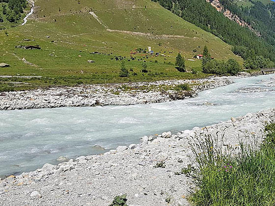
View along the east side of the river
The pleasant Valley Loop hike, starting in the center of Zinal, travels on a wide path along the west side of the Navisence River, crosses two bridges and then returns to via the east side of the river. This is a great walk for families with small children and a good option on a rainy day.
- Distance: 3.6 - 3.8 miles (Loop)
- Elevation: 5,450-ft. at Trailhead
Maximum elevation - 5,700-ft. - Elevation Gain: 250-ft.
- Difficulty: easy
- Basecamp: Zinal
- Region: The Valais
Trail Description - Zinal Valley Loop
Note: the mileage for this hike is measured starting at the tennis courts and ice skating rink in Zinal. The hike from this start/end point is 3.6 miles. If starting from the post office/bus stop, add 0.3 miles (round trip) to the hike.
In Zinal walk south along Rue des Cinque 4000, the town’s main street, to the parking lot at the south end of the village. Turn right into the parking lot and then cross the wood bridge over the Navisence River. On the west side of the river turn left (south) on the broad track signed for Petit Mountet and Grand Mountet. The track now travels through pastures on easy grades with nice views of Besso (12,001-ft.) towering above the east side of the valley.
At 1.7 miles reach a junction and turn left (east) toward Lac Arpitetta and the Arpitetta Hut. Follow the trail down to the river. The river here is braided into two channels, separated by a small island. Cross the first channel on a wood bridge, walk a short distance across the island and then cross a second wood bridge over the main channel to the east side of the river.
On the east side of the river, turn left (north) and follow a broad track back to the parking lot and village. Along the way you will find some picnic tables and a few spots to sit along the river. Before reaching the car park pass a restaurant on the right.
Hike Variations
If you want a longer walk along the river, from the post office walk south along Rue des Cinque 4000 and then turn right (west) on the narrow road between the Hotel Europe and the Restaurant La Ferme. Follow the road as it drops down to the Navisence River. Cross the river on the La Barmette Bridge and then turn left (south). Walk south (up valley) along the west side of the river. You can walk as far as the bridge at the car park at the south end of the village or walk all the way to bridge near the La Arpitettaz junction (described above) and then follow the trail back along the east side of the river. Total distance for this variation is 3.8 miles.
Elevation Profile
Driving Directions
Directions in Zinal: From the Post Office/Bus stop in Zinal, walk south along Rue des Cinque 4000 (the town’s main street). The mileage in this description starts the hike a few blocks beyond, near the tennis courts and ice skating rink.
From Grimentz to Zinal: From Grimentz, board the bus to Zinal and get off at the post office. If possible catch a direct bus to Zinal. Otherwise, take the Vissoie Bus to Vissoie where you will need to change for a bus headed up the valley to Zinal. The direct buses take 15 minutes. If you need to change in Vissoie the ride takes 58 minutes or longer.
Buses make several stops in Grimentz. Schedules are posted at the bus stops and are available online at the SBB website and the SBB app.
Trail Resources
- Trail Photo Gallery
- Trail Maps
- Basecamp(s) Information: Zinal
- Region Information: The Valais
- Other Hiking Regions in: Switzerland